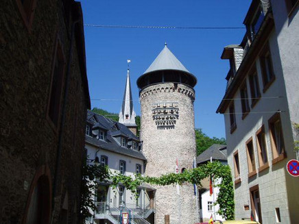
JAKOBSWEG - Pilgrims from Bullay to Traben-Trarbach
- start: Bullay train station
- destination: Trarbach pilgrims hostel
- medium
- 22,72 km
- 7 hours
- 686 m
- 415 m
- 92 m
- 100 / 100
- 60 / 100
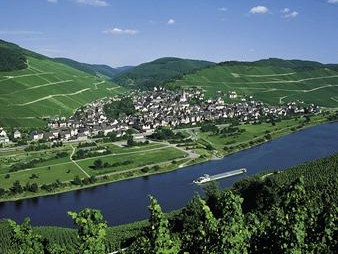
A pilgrimage with many different impressions. Time for reflection and peace, magnificent views, challenging climbs and beautiful forest and meadow paths can be experienced on this stage of the Moselcamino between Bullay and Traben-Trarbach.
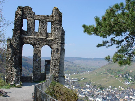
It is a demanding but rewarding tour. Spread over the route, three crisp climbs must be mastered. You are rewarded with views from the Marienburg, Bummkopf, Starkenburg and the ruins of Grevenburg. Pilgrims will find the necessary peace and quiet to let their thoughts run free and be inspired by nature.
There are many vantage points along the way, but there are also plenty of places to stop for refreshments in Zell, Enkirch and Traben-Trarbach.
General information
Directions
From Bullay station we follow the shell sign with yellow arrow over the railway bridge. We cross the pedestrian crossing and walk uphill until we see the signs: "Briedel 3 km and Zell-Kaimt 4 km". On the right is the Marienburg. But we go downhill on the left, first on tarred road, then on dirt road and reach Zell-Kaimt. Cross the Moselle on the pedestrian bridge and turn left and then immediately right into the pedestrian zone of Zell.
Along the main road we reach the roundabout and turn left into the road towards Hunsrück, then right.
We start in approx. 100 m altitude difference at the Branden-Burgstraße No. 34, follow the road to the roundabout, change sides approx. 100 m before, according to the shell signposting. Alternative: turn right to the Moselle bank, and then turn left at the roundabout towards Altlay.
At the former water treading pool we climb up in stages, following the good signs to the "Beimter Kopf" with the former cult building from Roman times. We continue uphill to the "Schönen Aussicht" at 375 m above sea level.
Now it is only about 500 m to the "Bummkopfhöhe" at 420 m above sea level.
We continue walking through the forest, well signposted by "M" and "Muschel", until we reach the "Fünftälerblick" above Enkirch. Arriving in Enkirch, we turn left at the Hotel Steffensberg, turn left upwards at the grocery shop, turn right at the sign for the MUSEUM, pass the church into Oberdorf, along the country road until almost at the end of the village (do not turn off to the cemetery!). At the end of the village turn right onto the path to the "Kirst", first resting place and entry in the hiking book at the "Rottenblick", a lookout point of the "Rotte 10 / 11" at the "Wanderweg der Lieder". Further uphill past several huts / shelters, wonderful views as far as Starken-burg. There you can stop for refreshments in the truly "Schönen Aussicht" or in the "Hüttenzauber", where delicious meals are served to you from Thursdays to Sundays from 11 am.
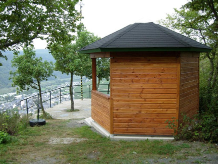
From Starkenburg we start with fantastic views into the valley, e.g. from the Starkenburg ruins, "Schöne Aussicht" or from the pavilion. We walk up along the edge of the forest to the Bismarckhütte (not yet rebuilt), from there downhill with a panoramic view of the Moselle and Traben and the Mont Royal (with vineyards, gliding airfield, high ropes course and office for GEO information).
On the new "Moselsteig", which was signposted and became accessible on 1 April 2011, we will reach the most beautiful view of Traben-Trarbach, the "Himmelspforte".
HIER GILT: Caution! Steep rock fall! Stay behind the barrier! Good shoes!
We continue downhill and reach the access road to Grevenburg with a 20% gradient. After a recommended rest we go down the time-honoured stairs to the district Trarbach and walk up the Kirchgasse to the pilgrim hostel "Alte Lateinschule" which is lovingly managed by Mrs. Ulrike Böcking since 2011.
Equipment
Hiking boots are required. Make sure you have enough provisions.
Tip
Pilgrims have the possibility to stay overnight in the pilgrims hostel "Old Latin School".
Pilgrim stamps can be obtained at the Traben-Trarbach Tourist Information.
Getting there
Public transport Bus or train
Parking
At the Bullay train station car park
Public transit
By bus or train
Literature
Karl-Josef Schäfer und Wolfgang Welter: Ein Jakobsweg von Koblenz-Stolzenfels nach Trier. Der Pilgerwanderführer für den Mosel-Camino. ISBN 978-3-8334-9888-6.
Maps
Moselle hiking area. Middle Mosel/Condel Forest. ISBN 978-89637-257-4
Additional Information
Tourist-Information Traben-Trarbach
Am Bahnhof 5
56841 Traben-Trarbach
+49 - (0)6541-83980
www.traben-trarbach.de
info@traben-trarbach.de
Pavings
- Crushed Rock (12%)
- Street (9%)
- Asphalt Coating (11%)
- Path (22%)
- Hiking Trail (44%)
- Unknown (1%)
Weather
This tour is presented by: Moselregion Traben-Trarbach Kröv, Author: Ingrid Ströher


