T 8 - Around the "Wolfer" Mountain
- start: On the banks of the Moselle in Trarbach
- destination: On the banks of the Moselle in Trarbach
- medium
- 11,14 km
- 3 hours 15 minutes
- 315 m
- 367 m
- 101 m
- 80 / 100
- 40 / 100
A hike that leads mainly through the forest and offers magnificent panoramic views of Wolf, Traben-Trarbach, Mont Royal and Starkenburg.
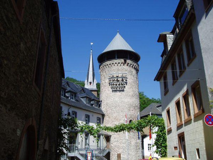
This hike leads from the Moselle bank Trarbach uphill through the vineyard "Taubenhaus" into the forest. Along the way we can admire fantastic views of Traben and the "Würzgarten" and "Königsberg" vineyards, the Mont Royal and the Rissbach district. After reaching the residential area Koppelberg, which is situated on a high altitude, the path leads us through the high forest, where we can enjoy the peace and quiet and the good air. Soon we reach an area with beautiful field flower meadows. Here we can admire daisies, lupines and other meadow flowers in early summer. Now we have reached the highest point of the hike with 365 m above sea level and on the opposite hill we can see the houses of Starkenburg. Now we walk downhill again to the town through the vineyard "Taubenhaus". At the end of the hike we can once again enjoy the view of Trarbach with its imposing buildings, the grammar school with former alumnat, the ruins of Grevenburg and the Protestant church with old Latin school.
General information
Directions
From the car park on the Trarbach bank of the Moselle through the Moselle and Weiherstraße straight on to the Weihertorplatz.
Follow Wildbadstraße for about 200 mtr. and turn right into Bernkasteler Weg directly after the fountain. After about 80 mtrs. turn right again into Weinbergsweg and continue straight on to the Taubenhaus vineyard - from here you can also see the white M = Moselhöhenweg markings.
At the tool shed of the Taubenhaus participants' association, the trail turns left and at the next crossroads it turns right again onto the path between vineyards and forest past the Ranzenberger Hütte (refuge) with a constant view of the Moselle, town and Grevenburg ruins. Then we reach the forest path and follow the trail markings left up into the forest. Soon we reach a bank with a wonderful panoramic view of the Rißbach district, Mont Royal, the Moselle loop and the Wolf district. We continue along this ascending path to the historic water reservoir/fountain and from here we turn left and continue uphill on the asphalt road above the Koppelberg. From here no longer follow the white M = Moselhöhenweg, but the asphalt road ascending to the left. Follow the third path to the left (at the bank) into the Hochwald and walk straight on for 2 km until you reach the television filling station. On this route there are always great views of the Moselle, the town, the ruins of Grevenburg and Starkenburg. After about 1.5 km, walk straight ahead, then turn sharp left and walk across the Compener Bächelchen stream back to the Taubenhaus vineyard. Here we cross the outward path and follow the footpath below Villa Sonora into Wolfer Weg. Here we reach the back of the Buddha Museum (access via the Moselle side of the building). Now we turn right over the Kautenbach and through the Moselle to the car park on the banks of the Moselle.
Equipment
The trail is comfortable to walk in trainers or light hiking boots.
Tip
In early summer, beautiful meadows of wildflowers bloom near the TV station with daisies, lupins and other meadow flowers.
Getting there
by car to Trarbach
Parking
on the car park Moselufer Trarbach
Public transit
with the Moselbahn bus line 333 to ZOB Traben or with the Moselweinbahn to Traben station, from there walk to Trarbach to the starting point
Maps
Topographic map of trails 1:25.000
Hiking area Moselle region Traben-Trarbach Kröv
ISBN: 978-3-944-620-24-4
Traben-Trarbach hiking map 1:25.000
available at the Traben-Trarbach Tourist Information
Additional Information
Tourist-Information Traben-Trarbach
Am Bahnhof 5
56841 Traben-Trarbach
+49 - (0) 6541-83980
www.traben-trarbach.de
info@traben-trarbach.de
Pavings
- Crushed Rock (12%)
- Street (6%)
- Asphalt Coating (2%)
- Path (1%)
- Hiking Trail (79%)
Weather

This tour is presented by: Moselregion Traben-Trarbach Kröv, Author: Ingrid Ströher


